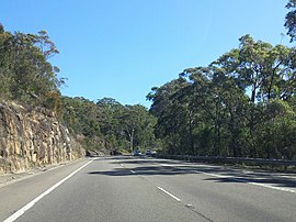
Lucas Heights, New South Wales
| Lucas Heights Sydney, New South Wales | |||||||||||||||
|---|---|---|---|---|---|---|---|---|---|---|---|---|---|---|---|
 | |||||||||||||||
 | |||||||||||||||
| Population | 4 (SAL 2021)[1] | ||||||||||||||
| Postcode(s) | 2234 | ||||||||||||||
| Elevation | 151 m (495 ft) | ||||||||||||||
| Location | 31 km (19 mi) south-west of Sydney CBD | ||||||||||||||
| LGA(s) | Sutherland Shire | ||||||||||||||
| State electorate(s) | Holsworthy | ||||||||||||||
| Federal division(s) | Hughes | ||||||||||||||
| |||||||||||||||
Lucas Heights is a suburb in southern Sydney, in the state of New South Wales, Australia. It is near to the Royal National Park.
Geography[edit]
It is located 31 kilometres south-west of the Sydney central business district, in the local government area of the Sutherland Shire. Lucas Heights is located on the Woronora River, which flows north into the Georges River.
Unusually for a suburb, Lucas Heights does not contain a residential area. The residential area previously part of Lucas Heights was renamed Barden Ridge in 1996 to increase the real estate value of the area, as it would no longer be instantly associated with the High Flux Australian Reactor (HIFAR).
History[edit]
Lucas Heights was named after John Lucas Senior, a flour miller who in 1823 was granted 150 acres (0.6 km2) on the 'head of unnamed stream into Georges River'. He built a water-driven mill for grinding corn from the Illawarra farms. Small ships sailed up the coast into Botany Bay, Georges River and the Woronora River.[2]
Commercial areas[edit]
Lucas Heights has become most notable as the site of the Australian Nuclear Science and Technology Organisation (ANSTO) research establishment originally created by the Australian Atomic Energy Commission and home to the historic HIFAR research nuclear reactor.
HIFAR was shut down in January 2007 and replaced by the OPAL research reactor. OPAL bears leading neutron radiation facilities and attracts international scientists as staff members and many hundreds of user groups. In 2005, Australian police suggested the HIFAR reactor was a possible target for a foiled terrorist bomb attack.[3]
Spent fuel from the OPAL reactor is transported to Port Kembla, then exported to France for reprocessing.[4]
The Australian Institute of Nuclear Science and Engineering (AINSE) also has its headquarters at Lucas Heights.[5]
Lucas Heights also hosts a (non-nuclear) waste-management facility, which was for many years a major disposal site for sanitary carters.
Climate[edit]
Due to its elevation, Lucas Heights is one of the few places in Sydney that has a borderline Oceanic (Cfb) and a Humid subtropical climate (Cfa).
| Climate data for Lucas Heights | |||||||||||||
|---|---|---|---|---|---|---|---|---|---|---|---|---|---|
| Month | Jan | Feb | Mar | Apr | May | Jun | Jul | Aug | Sep | Oct | Nov | Dec | Year |
| Record high °C (°F) | 41.2 (106.2) |
42.0 (107.6) |
39.8 (103.6) |
32.4 (90.3) |
26.9 (80.4) |
23.5 (74.3) |
24.0 (75.2) |
28.0 (82.4) |
34.4 (93.9) |
34.0 (93.2) |
41.5 (106.7) |
40.0 (104.0) |
42.0 (107.6) |
| Mean daily maximum °C (°F) | 25.9 (78.6) |
26.0 (78.8) |
24.7 (76.5) |
22.3 (72.1) |
18.9 (66.0) |
16.2 (61.2) |
15.8 (60.4) |
17.2 (63.0) |
19.5 (67.1) |
21.6 (70.9) |
23.4 (74.1) |
25.7 (78.3) |
21.4 (70.5) |
| Mean daily minimum °C (°F) | 17.4 (63.3) |
17.6 (63.7) |
16.1 (61.0) |
13.3 (55.9) |
10.1 (50.2) |
8.2 (46.8) |
6.6 (43.9) |
7.4 (45.3) |
9.4 (48.9) |
11.9 (53.4) |
13.7 (56.7) |
15.9 (60.6) |
12.3 (54.1) |
| Record low °C (°F) | 10.9 (51.6) |
11.1 (52.0) |
8.4 (47.1) |
5.6 (42.1) |
4.3 (39.7) |
−0.5 (31.1) |
−0.6 (30.9) |
1.6 (34.9) |
3.1 (37.6) |
3.5 (38.3) |
6.8 (44.2) |
8.8 (47.8) |
−0.6 (30.9) |
| Average precipitation mm (inches) | 92.5 (3.64) |
104.1 (4.10) |
119.0 (4.69) |
92.0 (3.62) |
79.9 (3.15) |
101.0 (3.98) |
59.6 (2.35) |
67.6 (2.66) |
51.8 (2.04) |
70.2 (2.76) |
92.9 (3.66) |
77.9 (3.07) |
1,007.6 (39.67) |
| Average precipitation days (≥ 0.2 mm) | 10.9 | 11.1 | 11.8 | 9.6 | 9.4 | 9.8 | 7.7 | 7.6 | 7.9 | 9.8 | 10.9 | 10.0 | 116.5 |
| Average relative humidity (%) | 62 | 63 | 63 | 58 | 58 | 61 | 52 | 51 | 52 | 57 | 57 | 57 | 57 |
| Source: [6] | |||||||||||||
References[edit]
- ^ Australian Bureau of Statistics (28 June 2022). "Lucas Heights (suburb and locality)". Australian Census 2021 QuickStats. Retrieved 28 June 2022.
- ^ The Book of Sydney Suburbs, Compiled by Frances Pollen, Angus & Robertson, 1990 ISBN 0-207-14495-8
- ^ "Nuclear link' to terror suspects". BBC News. 14 November 2005.
- ^ "Radioactive nuclear 'boomerang waste' moved out of Australia". Australian Broadcasting Corporation. 29 July 2018. Retrieved 15 December 2020.
- ^ "Contact Us". AINSE. Retrieved 18 March 2024.
- ^ "Climate statistics for LUCAS HEIGHTS (ANSTO)". Bureau of Meteorology. Retrieved 8 February 2014.
34°02′56″S 150°58′30″E / 34.049°S 150.975°E
