
Hendron, Kentucky
Hendron, Kentucky | |
|---|---|
 Location in Kentucky | |
| Coordinates: 37°2′16″N 88°38′42″W / 37.03778°N 88.64500°W | |
| Country | United States |
| State | Kentucky |
| County | McCracken |
| Area | |
| • Total | 5.37 sq mi (13.91 km2) |
| • Land | 5.35 sq mi (13.85 km2) |
| • Water | 0.02 sq mi (0.06 km2) |
| Elevation | 367 ft (112 m) |
| Population | |
| • Total | 4,774 |
| • Density | 892.50/sq mi (344.63/km2) |
| Time zone | UTC-6 (Central (CST)) |
| • Summer (DST) | UTC-5 (CDT) |
| ZIP code | 42003 (Paducah) |
| Area code(s) | 270 & 364 |
| FIPS code | 21-35902 |
| GNIS feature ID | 0494048 |
Hendron is an unincorporated community and census-designated place (CDP) in McCracken County, Kentucky, United States. The population was 4,774 at the 2020 census.[2] It is part of the Paducah, KY-IL Metropolitan Statistical Area.
History[edit]
Hendron was named for the local Hendron family.[3]
Geography[edit]
Hendron is located at 37°2′16″N 88°38′42″W / 37.03778°N 88.64500°W (37.037800, -88.644889)[4] and borders the southern edge of the city of Paducah. The original community of Hendron is in the northeast part of the CDP at Old Mayfield Road,[5] north of where it crosses Interstate 24. The Hendron CDP extends west as far as U.S. Route 45 and south as far as Yopp Lane, between South Friendship Road and Old Highway 45.[6]
Hendron is bordered to the west by the CDP of Massac, and the unincorporated community of Lone Oak along US 45 is split between the two CDPs.
According to the United States Census Bureau, the Hendron CDP has a total area of 5.37 square miles (13.91 km2), of which 0.02 square miles (0.05 km2), or 0.41%, are water.[1]
Demographics[edit]
| Census | Pop. | Note | %± |
|---|---|---|---|
| 1990 | 3,712 | — | |
| 2000 | 4,239 | 14.2% | |
| 2010 | 4,687 | 10.6% | |
| 2020 | 4,774 | 1.9% | |
| U.S. Decennial Census[7] | |||
As of the census[8] of 2000, there were 4,239 people, 1,832 households, and 1,278 families residing in the CDP. The population density was 816.7 inhabitants per square mile (315.3/km2). There were 1,932 housing units at an average density of 372.2 per square mile (143.7/km2). The racial makeup of the CDP was 95.59% White, 2.24% African American, 0.26% Native American, 0.66% Asian, 0.42% from other races, and 0.83% from two or more races. Hispanic or Latino of any race were 1.25% of the population.
There were 1,832 households, out of which 28.5% had children under the age of 18 living with them, 56.6% were married couples living together, 9.4% had a female householder with no husband present, and 30.2% were non-families. 26.9% of all households were made up of individuals, and 9.6% had someone living alone who was 65 years of age or older. The average household size was 2.30 and the average family size was 2.76.
In the CDP, the population was spread out, with 21.5% under the age of 18, 7.7% from 18 to 24, 28.0% from 25 to 44, 26.6% from 45 to 64, and 16.2% who were 65 years of age or older. The median age was 41 years. For every 100 females, there were 91.3 males. For every 100 females age 18 and over, there were 87.1 males.
The median income for a household in the CDP was $40,858, and the median income for a family was $49,401. Males had a median income of $45,870 versus $24,884 for females. The per capita income for the CDP was $22,984. About 3.8% of families and 7.0% of the population were below the poverty line, including 9.6% of those under age 18 and 9.2% of those age 65 or over.
Education[edit]
McCracken County Public Schools (MCPS), the school district that serves all areas in McCracken County except for the City of Paducah, has its headquarters in Hendron.[9][10][11]
References[edit]
- ^ a b "2022 U.S. Gazetteer Files: Kentucky". United States Census Bureau. Retrieved May 9, 2023.
- ^ a b "P1. Race – Hendron CDP, Kentucky: 2020 DEC Redistricting Data (PL 94-171)". U.S. Census Bureau. Retrieved May 9, 2023.
- ^ Rennick, Robert M. (1987). Kentucky Place Names. University Press of Kentucky. p. 138. ISBN 0813126312. Retrieved April 28, 2013.
- ^ "US Gazetteer files: 2010, 2000, and 1990". United States Census Bureau. February 12, 2011. Retrieved April 23, 2011.
- ^ "Hendron KY". ACME Mapper - USA Topo. Retrieved May 9, 2023.
- ^ "TIGERweb: Hendron CDP, Kentucky". Geography Division, U.S. Census Bureau. Retrieved May 9, 2023.
- ^ "Census of Population and Housing". Census.gov. Retrieved June 4, 2016.
- ^ "U.S. Census website". United States Census Bureau. Retrieved January 31, 2008.
- ^ "Home Archived 2011-01-24 at the Wayback Machine." McCracken County Public Schools. Retrieved on October 17, 2010. "435 Berger Rd Paducah, KY 42003."
- ^ "City of Paducah Map." City of Paducah. Retrieved on October 17, 2010.
- ^ "Hendron CDP, Kentucky[permanent dead link]." U.S. Census Bureau. Retrieved on October 17, 2010.
Municipalities and communities of McCracken County, Kentucky, United States | ||
|---|---|---|
| City | 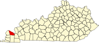 | |
| CDPs | ||
| Other communities | ||
| Footnotes | ‡This populated place also has portions in an adjacent county or counties | |