
Pasteur (lunar crater)
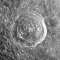
 Lunar Orbiter 2 image | |
| Coordinates | 11°54′S 104°36′E / 11.9°S 104.6°E |
|---|---|
| Diameter | 232.77 km |
| Colongitude | 259° at sunrise |
| Eponym | Louis Pasteur |
Pasteur is a large lunar impact crater, approximately 233 kilometers in diameter, belonging to the category termed a walled plain. It was named after French chemist and microbiologist Louis Pasteur.[1] It lies on the far side of the Moon as seen from the Earth, just beyond the eastern limb. The vicinity of this crater is occasionally brought into view from Earth due to librations, although not much detail can be seen.
Description[edit]
Lying along the southern rim of Pasteur is the smaller crater Backlund. Just to the southeast is Hilbert, another walled plain, nearly two-thirds the diameter of Pasteur. To the southwest is the prominent crater Sklodowska, and to the east is Meitner.
The outer rim of Pasteur is generally irregular, with sections being heavily damaged by multiple impacts. The northern rim in particular has been nearly obliterated by overlapping impacts, and the southern rim is not in much better shape with a stretch overlain by Backlund. The southeast rim of Pasteur is nearly linear near where the ground has been modified by Hilbert. Even the western rim is heavily damaged, with overlying craters Pasteur U, Anders' Earthrise crater, and Pasteur Q. (The first of these, Pasteur U, forms a merged group of overlapping craters.)
The interior is not in much better shape, with the southern half irregular from ejecta covering the surface, and several small craters lying across the floor. In the northwest part of the floor is a short chain of small, overlapping craters forming an arcing line from north to south. The satellite craters Pasteur G and Pasteur H form a pair to the east of the midpoint.
The satellite crater Pasteur D, to the northeast of Pateur, is fresh and has a ray system, and is consequently mapped as part of the Copernican System.[2]
Satellite craters[edit]


By convention these features are identified on lunar maps by placing the letter on the side of the crater midpoint that is closest to Pasteur.
| Pasteur | Latitude | Longitude | Diameter | Ref |
|---|---|---|---|---|
| A | 7.0° S | 105.7° E | 25.73 km | WGPSN |
| B | 8.2° S | 105.8° E | 19.44 km | WGPSN |
| D | 8.8° S | 108.8° E | 37.62 km | WGPSN |
| E | 10.8° S | 108.5° E | 18.9 km | WGPSN |
| G | 11.6° S | 105.7° E | 20.73 km | WGPSN |
| H | 12.1° S | 106.4° E | 21.6 km | WGPSN |
| M | 12.2° S | 104.6° E | 11.33 km | WGPSN |
| Q | 13.6° S | 101.5° E | 23.35 km | WGPSN |
| S | 12.2° S | 102.0° E | 28.76 km | WGPSN |
| U | 9.8° S | 101.5° E | 37.88 km | WGPSN |
| V | 9.0° S | 100.8° E | 22.49 km | WGPSN |
| Y | 8.0° S | 103.5° E | 49.85 km | WGPSN |
| Z | 6.8° S | 104.2° E | 13.98 km | WGPSN |
Pasteur T was renamed Anders' Earthrise in October 2018.
-
 Apollo 15 image of Pasteur D
 -
 Oblique Apollo 15 image of Pasteur D
 -
 Oblique view of Anders' Earthrise crater (formerly Pasteur T) from Apollo 17 panoramic camera


See also[edit]
- 4804 Pasteur, asteroid
References[edit]
- ^ "Lunar crater Pasteur". Gazetteer of Planetary Nomenclature. USGS Astrogeology Research Program.
- ^ The geologic history of the Moon, 1987, Wilhelms, Don E.; with sections by McCauley, John F.; Trask, Newell J. USGS Professional Paper: 1348. Plate 11: Copernican System (online)
- Andersson, L. E.; Whitaker, E. A. (1982). NASA Catalogue of Lunar Nomenclature. NASA RP-1097.
- Bussey, B.; Spudis, P. (2004). The Clementine Atlas of the Moon. New York: Cambridge University Press. ISBN 978-0-521-81528-4.
- Cocks, Elijah E.; Cocks, Josiah C. (1995). Who's Who on the Moon: A Biographical Dictionary of Lunar Nomenclature. Tudor Publishers. ISBN 978-0-936389-27-1.
- McDowell, Jonathan (July 15, 2007). "Lunar Nomenclature". Jonathan's Space Report. Retrieved 2007-10-24.
- Menzel, D. H.; Minnaert, M.; Levin, B.; Dollfus, A.; Bell, B. (1971). "Report on Lunar Nomenclature by the Working Group of Commission 17 of the IAU". Space Science Reviews. 12 (2): 136–186. Bibcode:1971SSRv...12..136M. doi:10.1007/BF00171763. S2CID 122125855.
- Moore, Patrick (2001). On the Moon. Sterling Publishing Co. ISBN 978-0-304-35469-6.
- Price, Fred W. (1988). The Moon Observer's Handbook. Cambridge University Press. ISBN 978-0-521-33500-3.
- Rükl, Antonín (1990). Atlas of the Moon. Kalmbach Books. ISBN 978-0-913135-17-4.
- Webb, Rev. T. W. (1962). Celestial Objects for Common Telescopes (6th revised ed.). Dover. ISBN 978-0-486-20917-3.
- Whitaker, Ewen A. (1999). Mapping and Naming the Moon. Cambridge University Press. ISBN 978-0-521-62248-6.
- Wlasuk, Peter T. (2000). Observing the Moon. Springer. ISBN 978-1-85233-193-1.