
Poydras, Louisiana
Poydras | |
|---|---|
Census-designated place | |
 Historic Canary Islanders Home, Poydras | |
 Location in St. Bernard Parish and the state of Louisiana. | |
| Coordinates: 29°52′11″N 89°53′20″W / 29.86972°N 89.88889°W | |
| Country | United States |
| State | Louisiana |
| Parish | St. Bernard |
| Area | |
| • Total | 4.27 sq mi (11.06 km2) |
| • Land | 3.91 sq mi (10.12 km2) |
| • Water | 0.36 sq mi (0.94 km2) |
| Elevation | 7 ft (2 m) |
| Population (2020) | |
| • Total | 2,536 |
| • Density | 648.93/sq mi (250.55/km2) |
| Time zone | UTC-6 (CST) |
| • Summer (DST) | UTC-5 (CDT) |
| Area code | 504 |
| FIPS code | 22-62280 |
Poydras is a census-designated place (CDP) in St. Bernard Parish, Louisiana, United States. The population was 3,886 at the 2000 census and 2,536 in 2020. It is part of the New Orleans–Metairie–Kenner Metropolitan Statistical Area. Poydras is on the East Bank of the Mississippi River, just upriver from the Plaquemines Parish line.
History[edit]
Poydras was first settled in the 18th century by Isleños when Louisiana was a Spanish colony. Presumably, the town is named for Julien Poydras.
Albert Estopinal, Jr., a St. Bernard Parish district attorney, judge, and sheriff, was born in Poydras in 1869 to later U.S. Representative, Albert Estopinal, Sr.[2]
The locally constructed levee failed during the 1922 flood and the community of Poydras was destroyed. Some historians claim that the levee break was intentional to save the City of New Orleans.[3] The New Orleans river stage dropped .2 foot within 24 hours of the Poydras crevasse and a sound levee had been inspected and reported only 30 minutes before the breach occurred.[4]
Poydras was severely damaged by the impact of Hurricane Katrina on 29 August 2005.
Geography[edit]
Poydras is located at 29°52′11″N 89°53′20″W / 29.86972°N 89.88889°W (29.869696, -89.888955).[5]
According to the United States Census Bureau, the CDP has a total area of 4.4 square miles (11 km2), of which 4.2 square miles (11 km2) is land and 0.2 square miles (0.52 km2) (4.81%) is water.
Demographics[edit]
| Census | Pop. | Note | %± |
|---|---|---|---|
| 2020 | 2,536 | — | |
| U.S. Decennial Census[6] | |||
| Race | Number | Percentage |
|---|---|---|
| White (non-Hispanic) | 1,584 | 62.46% |
| Black or African American (non-Hispanic) | 373 | 14.71% |
| Native American | 20 | 0.79% |
| Asian | 11 | 0.43% |
| Other/Mixed | 109 | 4.3% |
| Hispanic or Latino | 439 | 17.31% |
As of the census[8] of 2000, there were 3,886 people, 1,361 households, and 1,023 families residing in the CDP. The population density was 934.2 inhabitants per square mile (360.7/km2). There were 1,518 housing units at an average density of 364.9 per square mile (140.9/km2). According to the 2020 United States census, there were 2,536 people, 944 households, and 638 families residing in the CDP. The racial makeup of the CDP was 87.88% White, 8.65% African American, 0.77% Native American, 0.57% Asian, 0.05% Pacific Islander, 0.54% from other races, and 1.54% from two or more races in 2000. Hispanic or Latinos of any race were 5.22% of the population. By 2020 its racial makeup was 62.46% non-Hispanic white, 14.71% Black or African American, 0.79% Native American, 0.43% Asian, 4.3% multiracial or another race, and 17.31% Hispanic or Latino of any race, reflecting the demographic shift of American self-identification.[9]
Education[edit]
Residents are zoned to schools in the St. Bernard Parish Public Schools.
As of 2015 Chalmette High School serves the population.
References[edit]
- ^ "2020 U.S. Gazetteer Files". United States Census Bureau. Retrieved March 20, 2022.
- ^ "Estopinal, Jr., Albert". lahistory.org. Archived from the original on December 1, 2010. Retrieved January 8, 2011.
- ^ Kelman, Ari. (2003) A river and its city: the nature of landscape in New Orleans. Berkeley and Los Angeles, CA: University of California Press, p. 173. ISBN 0-520-23432-4.
- ^ Bragg, Marion. (1977) Historic names and places on the lower Mississippi River. Vicksburg, Miss: Mississippi River Commission. p. 253. Retrieved 17 August 2015. US Army Corps of Engineers website
- ^ "US Gazetteer files: 2010, 2000, and 1990". United States Census Bureau. February 12, 2011. Retrieved April 23, 2011.
- ^ "Census of Population and Housing". Census.gov. Retrieved June 4, 2016.
- ^ "Explore Census Data". data.census.gov. Retrieved December 28, 2021.
- ^ "U.S. Census website". United States Census Bureau. Retrieved January 31, 2008.
- ^ Frey, William H. (August 13, 2021). "New 2020 census results show increased diversity countering decade-long declines in America's white and youth populations". Brookings. Retrieved February 16, 2022.
Municipalities and communities of St. Bernard Parish, Louisiana, United States | ||
|---|---|---|
| CDPs | 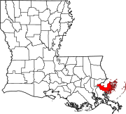 | |
| Other communities | ||
| Ghost towns | ||