Kottbusser Tor (Berlin U-Bahn)
This article needs additional citations for verification. (December 2009) |
 | ||||||||||||||||||||
| General information | ||||||||||||||||||||
| Location | Kottbusser Tor Kreuzberg, Berlin Germany | |||||||||||||||||||
| Coordinates | 52°29′57″N 13°25′05″E / 52.49917°N 13.41806°E | |||||||||||||||||||
| Owned by | Berliner Verkehrsbetriebe | |||||||||||||||||||
| Operated by | Berliner Verkehrsbetriebe | |||||||||||||||||||
| Platforms | 2 island platforms | |||||||||||||||||||
| Tracks | 4 | |||||||||||||||||||
| Connections | ||||||||||||||||||||
| Construction | ||||||||||||||||||||
| Structure type |
| |||||||||||||||||||
| Bicycle facilities | Yes | |||||||||||||||||||
| Accessible | Yes | |||||||||||||||||||
| Other information | ||||||||||||||||||||
| Fare zone | ||||||||||||||||||||
| History | ||||||||||||||||||||
| Opened | 15 February 1902 (U1/3 level) 12 February 1928 (U8 level) | |||||||||||||||||||
| Services | ||||||||||||||||||||
| ||||||||||||||||||||
| Location | ||||||||||||||||||||


Kottbusser Tor (German pronunciation: [ˌkɔtbʊsɐ ˈtoːɐ̯] ⓘ) is a Berlin U-Bahn station located on lines U1, U3, and U8. Many Berliners use the affectionate term Kotti (German pronunciation: [ˈkɔti] ⓘ; see Berlin dialect).
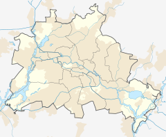
It is located in central Kreuzberg. The area has a bad reputation for the relatively high, mainly drug-related crime rate, instances of which have recently[when?] become quite rare in most other parts of the district[citation needed]. The original Kottbusser Tor was a southern city gate of Berlin; the road through the gate led via the Neukölln suburb to the town of Cottbus.
Trivia - K and missing h (Cotbusser Thor) rely to a language reform at begin of 20th century. See e.g., Stralauer T(h)or, or Cölln and Neukölln.
History[edit]
The station on the first U-Bahn line from Potsdamer Platz to Stralauer Tor was opened on 18 February 1902 on a viaduct above Skalitzer Straße. When the U8 was built in 1926, a new two-level station was constructed 100 metres (330 ft) westwards to allow both lines to meet in one location, and the original station was demolished.[2]
It was directly hit on 26 February 1945.[citation needed]
Gallery[edit]
-
U1/U3 platform
-
U8 platform
-
Kottbusser Tor station at night
References[edit]
- ^ "Alle Zielorte". Verkehrsverbund Berlin-Brandenburg. 1 January 2021. p. 63. Retrieved 5 May 2021.
- ^ J. Meyer-Kronthaler: Berlins U-Bahnhöfe. be.bra Verlag (1996)


