
Sebastopol, Mississippi
Sebastopol, Mississippi | |
|---|---|
Town | |
 Location of Sebastopol, Mississippi | |
 Sebastopol, Mississippi Location in the United States | |
| Coordinates: 32°34′22″N 89°20′10″W / 32.57278°N 89.33611°W | |
| Country | United States |
| State | Mississippi |
| County | Scott, Leake |
| Area | |
| • Total | 1.57 sq mi (4.06 km2) |
| • Land | 1.57 sq mi (4.06 km2) |
| • Water | 0.00 sq mi (0.00 km2) |
| Elevation | 420 ft (128 m) |
| Population (2020) | |
| • Total | 266 |
| • Density | 169.75/sq mi (65.55/km2) |
| Time zone | UTC-6 (Central (CST)) |
| • Summer (DST) | UTC-5 (CDT) |
| ZIP code | 39359 |
| Area code | 601 |
| FIPS code | 28-66280 |
| GNIS feature ID | 0677487 |
Sebastopol is a town in Leake and Scott counties, Mississippi. The population was 266 at the 2020 census.[2]
History[edit]
This section needs additional citations for verification. (July 2020) |
Sebastopol was originally called "Hathaway Springs". The town was in existence before the Civil War but not incorporated until 1917. According to oral tradition, "a Swede" traveling through the area named the town for Sevastopol, Crimea. It is rumored that the "Swede" was Frederick Law Olmsted (of Central Park fame) who stayed at Sebastopol House in Seguin, Texas during his travels throughout the southern United States. From 1852 to 1857, Olmsted was sent to the southern United States by his employer, The New York Times, to study and write about slavery. It was published as Journeys and Explorations in the Cotton Kingdom.
Each fall season Sebastopol has Sebastopolooza–a fairly large fall festival. In 2010 Sebastopolooza had over a thousand people.[3]
Sebastopol is centrally located between four larger towns, the towns of Forest, Carthage, Union and Philadelphia. Although the town has a local grocery store, most people drive to one of the larger towns to purchase basic household goods. The nearest theatre is a small local operation located in Philadelphia, Mississippi.[citation needed]
The town got access to cable TV in the late 1990s, which has yet to be offered to areas located just outside the city limits. Most local people wishing to have television must subscribe to satellite programming. This makes accessibility to high-speed internet almost impossible. On October 11, 2010, all cable services from Sky Cablevision, the only cable provider for Sebastopol, were disconnected.[why?][citation needed]
Geography[edit]
Most of the town is located in Scott County, with a small portion in Leake County. In the 2000 census, all of the city's 233 residents lived in Scott County. No residents lived in the Leake County portion in 2000, and one person lived there in 2006.[4]
According to the United States Census Bureau, the town has a total area of 1.5 square miles (3.9 km2), all land.
Demographics[edit]
| Census | Pop. | Note | %± |
|---|---|---|---|
| 1930 | 355 | — | |
| 1940 | 403 | 13.5% | |
| 1950 | 330 | −18.1% | |
| 1960 | 343 | 3.9% | |
| 1970 | 268 | −21.9% | |
| 1980 | 314 | 17.2% | |
| 1990 | 281 | −10.5% | |
| 2000 | 233 | −17.1% | |
| 2010 | 272 | 16.7% | |
| 2020 | 266 | −2.2% | |
| U.S. Decennial Census[5] | |||
| Race | Number | Percentage |
|---|---|---|
| White (NH) | 207 | 77.82% |
| Black or African American (NH) | 45 | 16.92% |
| Native American or Alaska Native (NH) | 1 | 0.38% |
| Mixed/Multi-Racial (NH) | 3 | 1.13% |
| Hispanic or Latino | 10 | 3.76% |
| Total | 278 |
As of the 2020 United States census, there were 266 people, 115 households, and 81 families residing in the town.
As of the census[9] of 2000, there were 233 people, 107 households, and 66 families residing in the town. The population density was 159.4 inhabitants per square mile (61.5/km2). There were 118 housing units at an average density of 80.7 per square mile (31.2/km2). The racial makeup of the town was 95.28% White, 3.00% African American, 0.86% Native American, 0.86% from other races. Hispanic or Latino of any race were 1.72% of the population.
There were 107 households, out of which 28.0% had children under the age of 18 living with them, 46.7% were married couples living together, 10.3% had a female householder with no husband present, and 38.3% were non-families. 37.4% of all households were made up of individuals, and 18.7% had someone living alone who was 65 years of age or older. The average household size was 2.18 and the average family size was 2.83.
In the town, the age distribution of the population shows 21.5% under the age of 18, 9.4% from 18 to 24, 26.6% from 25 to 44, 24.9% from 45 to 64, and 17.6% who were 65 years of age or older. The median age was 40 years. For every 100 females, there were 95.8 males. For every 100 females age 18 and over, there were 92.6 males.
The median income for a household in the town was $31,250, and the median income for a family was $47,500. Males had a median income of $26,625 versus $25,000 for females. The per capita income for the town was $23,630. About 9.5% of families and 18.6% of the population were below the poverty line, including 23.8% of those under the age of eighteen and 28.2% of those sixty-five or over.
Education[edit]
The Town of Sebastopol is served by the Scott County School District.[10] The town has one public High School whose mascot is the Sebastopol Bobcats. Sebastopol also has a private school, Pine Grove Christian Academy, owned and operated by Pine Grove Pentecostal Church.[citation needed]
Notable people[edit]
References[edit]
- ^ "2020 U.S. Gazetteer Files". United States Census Bureau. Retrieved July 24, 2022.
- ^ News-Leader, Springfield. "500 | data.news-leader.com | news-leader.com". Springfield News-Leader. Retrieved October 21, 2021.
- ^ "Sebastopolooza Brings Thousands". www.wtok.com. Archived from the original on November 1, 2010.
- ^ "Subcounty population estimates: Mississippi 2000-2006". United States Census Bureau, Population Division. June 28, 2007. Archived from the original (CSV) on November 26, 2007. Retrieved July 21, 2007.
- ^ "Census of Population and Housing". Census.gov. Retrieved June 4, 2015.
- ^ "Explore Census Data". data.census.gov. Retrieved June 1, 2022.
- ^ https://www.census.gov/ [not specific enough to verify]
- ^ "About the Hispanic Population and its Origin". www.census.gov. Retrieved May 18, 2022.
- ^ "U.S. Census website". United States Census Bureau. Retrieved January 31, 2008.
- ^ "2020 CENSUS - SCHOOL DISTRICT REFERENCE MAP: Scott County, MS" (PDF). U.S. Census Bureau. Archived (PDF) from the original on August 7, 2022. Retrieved August 6, 2022. - Text list
- ^ McAllister, Ed. "Leake County Revelers". Mississippi Encyclopedia. Retrieved January 14, 2023.
Municipalities and communities of Leake County, Mississippi, United States | ||
|---|---|---|
| City |  | |
| Towns | ||
| CDPs | ||
| Communities | ||
| Indian reservation | ||
| Footnotes | ‡This populated place also has portions in an adjacent county or counties | |
Municipalities and communities of Scott County, Mississippi, United States | ||
|---|---|---|
| Cities | 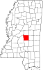 | |
| Towns | ||
| CDPs | ||
| Other communities | ||
| Indian reservation | ||
| Footnotes | ‡This populated place also has portions in an adjacent county or counties | |
| International | |
|---|---|
| National | |
| Other | |