
Pennington Gap, Virginia
Pennington Gap, Virginia | |
|---|---|
 Morgan Street downtown (2017) | |
 Seal | |
 Location of Pennington Gap, Virginia | |
| Coordinates: 36°45′24″N 83°1′46″W / 36.75667°N 83.02944°W | |
| Country | United States |
| State | Virginia |
| County | Lee |
| Area | |
| • Total | 1.69 sq mi (4.37 km2) |
| • Land | 1.67 sq mi (4.32 km2) |
| • Water | 0.02 sq mi (0.05 km2) |
| Elevation | 1,388 ft (423 m) |
| Population (2020) | |
| • Total | 1,624 |
| • Density | 960/sq mi (370/km2) |
| Time zone | UTC−5 (Eastern (EST)) |
| • Summer (DST) | UTC−4 (EDT) |
| ZIP Code | 24277 |
| Area code | 276 |
| FIPS code | 51-61560 [2] |
| GNIS feature ID | 1486137 [2] |
| Website | townofpenningtonva.gov |
Pennington Gap is a town in Lee County, Virginia, United States.[2] The population was 1,624 at the 2020 census.
History[edit]
The Pennington Gap post office was established in 1891.[3]
The Lee Regional Medical Center was in Pennington Gap until it closed in October 2013.[4]
Geography[edit]
Pennington Gap is located at 36°45′24″N 83°1′46″W / 36.75667°N 83.02944°W (36.756580, −83.029375).[5]
According to the United States Census Bureau, the town has a total area of 1.5 square miles (3.9 km2), all of it land.
Pennington Gap is located at the junction of U.S. Route 58A and U.S. Route 421.
Climate[edit]
The climate in this area is characterized by hot, humid summers and generally mild to cool winters. According to the Köppen Climate Classification system, Pennington Gap has a humid subtropical climate, abbreviated "Cfa" on climate maps.[6]
| Climate data for Pennington Gap, Virginia (1991–2020 normals, extremes 1931–present) | |||||||||||||
|---|---|---|---|---|---|---|---|---|---|---|---|---|---|
| Month | Jan | Feb | Mar | Apr | May | Jun | Jul | Aug | Sep | Oct | Nov | Dec | Year |
| Record high °F (°C) | 76 (24) |
80 (27) |
90 (32) |
89 (32) |
94 (34) |
100 (38) |
105 (41) |
101 (38) |
101 (38) |
94 (34) |
85 (29) |
78 (26) |
105 (41) |
| Mean daily maximum °F (°C) | 44.8 (7.1) |
49.3 (9.6) |
58.7 (14.8) |
68.7 (20.4) |
76.1 (24.5) |
82.8 (28.2) |
85.3 (29.6) |
84.9 (29.4) |
80.7 (27.1) |
70.5 (21.4) |
58.2 (14.6) |
48.4 (9.1) |
67.4 (19.7) |
| Daily mean °F (°C) | 34.0 (1.1) |
37.5 (3.1) |
45.2 (7.3) |
54.1 (12.3) |
63.0 (17.2) |
70.7 (21.5) |
74.1 (23.4) |
73.2 (22.9) |
67.7 (19.8) |
56.1 (13.4) |
44.9 (7.2) |
37.3 (2.9) |
54.8 (12.7) |
| Mean daily minimum °F (°C) | 23.2 (−4.9) |
25.7 (−3.5) |
31.7 (−0.2) |
39.6 (4.2) |
49.9 (9.9) |
58.7 (14.8) |
62.8 (17.1) |
61.6 (16.4) |
54.6 (12.6) |
41.7 (5.4) |
31.5 (−0.3) |
26.3 (−3.2) |
42.3 (5.7) |
| Record low °F (°C) | −25 (−32) |
−21 (−29) |
−8 (−22) |
16 (−9) |
24 (−4) |
32 (0) |
41 (5) |
36 (2) |
28 (−2) |
16 (−9) |
3 (−16) |
−16 (−27) |
−25 (−32) |
| Average precipitation inches (mm) | 4.41 (112) |
4.37 (111) |
4.86 (123) |
4.59 (117) |
4.32 (110) |
4.39 (112) |
4.44 (113) |
3.95 (100) |
3.71 (94) |
2.99 (76) |
2.88 (73) |
4.77 (121) |
49.68 (1,262) |
| Average snowfall inches (cm) | 3.5 (8.9) |
2.8 (7.1) |
1.1 (2.8) |
0.1 (0.25) |
0.0 (0.0) |
0.0 (0.0) |
0.0 (0.0) |
0.0 (0.0) |
0.0 (0.0) |
0.0 (0.0) |
0.0 (0.0) |
1.8 (4.6) |
9.3 (24) |
| Average precipitation days (≥ 0.01 in) | 10.9 | 10.1 | 11.8 | 10.8 | 12.1 | 12.2 | 12.9 | 10.5 | 7.9 | 7.9 | 8.5 | 10.8 | 126.4 |
| Average snowy days (≥ 0.1 in) | 1.8 | 1.6 | 0.7 | 0.2 | 0.0 | 0.0 | 0.0 | 0.0 | 0.0 | 0.0 | 0.0 | 0.8 | 5.1 |
| Source: NOAA[7][8] | |||||||||||||
Demographics[edit]
| Census | Pop. | Note | %± |
|---|---|---|---|
| 1900 | 399 | — | |
| 1910 | 792 | 98.5% | |
| 1920 | 940 | 18.7% | |
| 1930 | 1,553 | 65.2% | |
| 1940 | 1,990 | 28.1% | |
| 1950 | 2,090 | 5.0% | |
| 1960 | 1,799 | −13.9% | |
| 1970 | 1,886 | 4.8% | |
| 1980 | 1,716 | −9.0% | |
| 1990 | 1,922 | 12.0% | |
| 2000 | 1,781 | −7.3% | |
| 2010 | 1,781 | 0.0% | |
| 2020 | 1,624 | −8.8% | |
| U.S. Decennial Census[9] | |||
At the 2020 census there were 1,624 people living in the town.
2000 census[edit]
At the 2000 census there were 1,781 people, 811 households, and 480 families living in the town. The population density was 1,174.0 people per square mile (452.4/km2). There were 950 housing units at an average density of 626.2 per square mile (241.3/km2). The racial makeup of the town was 95.28% White, 3.43% African American, 0.39% Native American, 0.28% Asian, and 0.62% from two or more races. Hispanic or Latino of any race were 0.67%.[10]
Of the 811 households 22.9% had children under the age of 18 living with them, 40.4% were married couples living together, 16.2% had a female householder with no husband present, and 40.8% were non-families. 37.5% of households were one person and 16.8% were one person aged 65 or older. The average household size was 2.15 and the average family size was 2.84.
The age distribution was 20.5% under the age of 18, 7.2% from 18 to 24, 25.4% from 25 to 44, 25.3% from 45 to 64, and 21.6% 65 or older. The median age was 42 years. For every 100 females, there were 81.4 males. For every 100 females aged 18 and over, there were 74.6 males.
The median household income was $18,056 and the median family income was $27,875. Males had a median income of $27,885 versus $18,625 for females. The per capita income for the town was $13,742. About 28.3% of families and 31.3% of the population were below the poverty line, including 42.0% of those under age 18 and 24.7% of those age 65 or over.
Government[edit]
The Federal Bureau of Prisons United States Penitentiary, Lee is located in the Lee County Industrial Park in unincorporated Lee County, Virginia, near Pennington Gap.[11]
Education[edit]
Lee County Public Schools operates schools in the county.
Pennington Elementary School was located on Morgan Avenue, consisting of three buildings built at various times, 1912, 1917, and 1937.
In 1989, with the consolidation of many of the county's high schools at the newly constructed Lee High School, the old Pennington High School was converted into Pennington Middle School (grades 5–7).
Notable people[edit]
- Barry Audia, pro boxer
- Claude Ely, preacher and songwriter
- Jim Pankovits, pro baseball player
- William C. Wampler, representative to the United States Congress
- Carol S. Wood, mathematician
References[edit]
- ^ "2019 U.S. Gazetteer Files". United States Census Bureau. Retrieved August 7, 2020.
- ^ a b c d "Pennington Gap, Virginia", Geographic Names Information System, United States Geological Survey, United States Department of the Interior
- ^ "Lee County". Jim Forte Postal History. Retrieved September 30, 2014.
- ^ "Lee Regional Medical Center shuts down | News - Home". Archived from the original on February 19, 2014. Retrieved February 2, 2014.
- ^ "US Gazetteer files: 2010, 2000, and 1990". United States Census Bureau. February 12, 2011. Retrieved April 23, 2011.
- ^ "Pennington Gap, Virginia Köppen Climate Classification (Weatherbase)". Weatherbase. Retrieved April 18, 2018.
- ^ "NowData – NOAA Online Weather Data". National Oceanic and Atmospheric Administration. Retrieved June 28, 2021.
- ^ "Station: Pennington Gap, VA". U.S. Climate Normals 2020: U.S. Monthly Climate Normals (1991-2020). National Oceanic and Atmospheric Administration. Retrieved June 28, 2021.
- ^ "Census of Population and Housing". Census.gov. Retrieved June 4, 2015.
- ^ "U.S. Census website". United States Census Bureau. Retrieved January 31, 2008.
- ^ "USP Lee Contact Information." Federal Bureau of Prisons. Retrieved on August 23, 2010.
Municipalities and communities of Lee County, Virginia, United States | ||
|---|---|---|
| Towns | 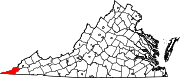 | |
| CDPs | ||
| Unincorporated communities |
| |
| Ghost town | ||
| International | |
|---|---|
| National | |
| Other | |