
Tabernash, Colorado
Tabernash, Colorado | |
|---|---|
 Tabernash in 2016. | |
 Location of the Tabernash CDP in Grand County, Colorado. | |
 Tabernash Location of the Tabernash CDP in the United States. | |
| Coordinates: 39°58′44″N 105°50′39″W / 39.97889°N 105.84417°W[1] | |
| Country | |
| State | |
| County | Grand County |
| Government | |
| • Type | unincorporated town |
| Area | |
| • Total | 4.747 sq mi (12.295 km2) |
| • Land | 4.747 sq mi (12.295 km2) |
| • Water | 0.000 sq mi (0.000 km2) |
| Elevation | 8,403 ft (2,561 m) |
| Population | |
| • Total | 401 |
| • Density | 84/sq mi (33/km2) |
| Time zone | UTC-7 (MST) |
| • Summer (DST) | UTC-6 (MDT) |
| ZIP Code[4] | 80478 |
| Area code | 970 |
| GNIS feature ID | 2410044[1] |
Tabernash is an unincorporated town, a post office, and a census-designated place (CDP) located in and governed by Grand County, Colorado, United States. The Tabernash post office has the ZIP Code 80478.[4] At the United States Census 2020, the population of the Tabernash CDP was 401.[3]
History[edit]
The Tabernash Post Office has been in operation since 1905.[5] The community has the name of a Ute Indian.[6]
1984 airplane crash[edit]
On August 10, 1984, a Cessna L-19 Bird Dog (registration N4584A)[7], piloted by James Jeb Caddell, 36, crashed in a forest near Tabernash. The aircraft was en route from Granby to Jeffco Airport, Colorado. The wreckage was found by backpackers three years later on August 23, 1987. A 6½ minute video shot from a VHS camcorder mounted on the instrument panel was found at the site. The heavily damaged tape, some of it hanging from tree branches, was recovered and repaired by Colorado deputy sheriff Dale Wood. Subsequent analysis of the footage revealed that the pilot had not taken into account the density altitude conditions that existed on the day of the flight. The aircraft was unable to climb away from steadily rising terrain. In an attempt to return to the departure airfield, the pneumatic stall warning of the airplane sounded three times during a turn to the right. The pilot could be heard yelling, "Damn, hang on Ronnie!" to his one backseat passenger, Ronald Hugh Wilmond, 36, three seconds before impacting the terrain and trees.[8]
The Caddells had put a 20-year moratorium (via the FAA) on the release of the film to the general public with the only stipulation that it (at the FAA's request to the Caddells) be shown only to flight instructors at conventions and workshops. The moratorium eventually expired and was not renewed, and thus the footage became part of the public domain. The video is now viewable on YouTube.[9]
Geography[edit]
Tabernash is located in the valley of the Fraser River. U.S. Route 40 passes through the community, leading northwest 11 miles (18 km) to Granby and southeast 9 miles (14 km) to Winter Park.
The Tabernash CDP has an area of 3,038 acres (12.295 km2), all land.[2]
Climate[edit]
This climate type is dominated by the winter season, a long, bitterly cold period with short, clear days, relatively little precipitation mostly in the form of snow, and low humidity. According to the Köppen Climate Classification system, Tabernash has a subarctic climate, abbreviated "Dfc" on climate maps.[10]
Demographics[edit]
The United States Census Bureau initially defined the Tabernash CDP for the United States Census 2000.
| Year | Pop. | ±% |
|---|---|---|
| 2000 | 165 | — |
| 2010 | 417 | +152.7% |
| 2020 | 401 | −3.8% |
| Source: United States Census Bureau | ||
See also[edit]
References[edit]
- ^ a b c d U.S. Geological Survey Geographic Names Information System: Tabernash, Colorado
- ^ a b "State of Colorado Census Designated Places - BAS20 - Data as of January 1, 2020". United States Census Bureau. Retrieved December 19, 2020.
- ^ a b United States Census Bureau. "Tabernash CDP, Colorado". Retrieved April 15, 2023.
- ^ a b "Look Up a ZIP Code". United States Postal Service. Retrieved December 22, 2020.
- ^ "Post offices". Jim Forte Postal History. Retrieved July 11, 2016.
- ^ Dawson, John Frank. Place names in Colorado: Why 700 communities were so named, 150 of Spanish or Indian origin. Denver, CO: J. Frank Dawson Publishing Co. p. 48.
- ^ "FAA Registry (N4584A)". Federal Aviation Administration.
- ^ "The wreckage of a small plane that crashed three..." United Press International. August 27, 1987. Retrieved September 23, 2023.
- ^ Cessna L-19E Bird Dog Crash 1984 (Tabernash, Colorado). Retrieved July 7, 2023.
- ^ Climate summary for Tabernash, Colorado
External links[edit]
 Definitions from Wiktionary
 Media from Commons
 News from Wikinews
 Quotations from Wikiquote
 Texts from Wikisource
 Textbooks from Wikibooks
 Resources from Wikiversity
Municipalities and communities of Grand County, Colorado, United States | ||
|---|---|---|
| Towns | 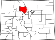 | |
| CDPs | ||
| Unincorporated communities | ||
| Ghost towns | ||