
Alamo Township, Michigan
Alamo Township, Michigan | |
|---|---|
 Location within Kalamazoo County | |
 Alamo Township Location within the state of Michigan  Alamo Township Location within the United States | |
| Coordinates: 42°22′51″N 85°41′38″W / 42.38083°N 85.69389°W | |
| Country | United States |
| State | Michigan |
| County | Kalamazoo |
| Area | |
| • Total | 36.4 sq mi (94.3 km2) |
| • Land | 36.2 sq mi (93.8 km2) |
| • Water | 0.2 sq mi (0.5 km2) |
| Elevation | 771 ft (235 m) |
| Population (2010) | |
| • Total | 3,762 |
| • Density | 104/sq mi (40.1/km2) |
| Time zone | UTC-5 (Eastern (EST)) |
| • Summer (DST) | UTC-4 (EDT) |
| FIPS code | 26-00840[1] |
| GNIS feature ID | 1625810[2] |
| Website | www |
Alamo Township is a civil township of Kalamazoo County in the U.S. state of Michigan. As of the 2020 census, the township population was 3,805.[3]
Geography[edit]
The township is in the northwest corner of Kalamazoo County and is bordered by Allegan County to the north and Van Buren County to the west. U.S. Route 131 passes through the east side of the township, leading south to Kalamazoo and north to Grand Rapids.
According to the United States Census Bureau, the township has a total area of 36.4 square miles (94.3 km2), of which 36.2 square miles (93.8 km2) are land and 0.2 square miles (0.5 km2), or 0.53%, are water.[3]
Demographics[edit]
As of the census[1] of 2000, there were 3,820 people, 1,378 households, and 1,091 families residing in the township. The population density was 105.3 inhabitants per square mile (40.7/km2). There were 1,424 housing units at an average density of 39.2 per square mile (15.1/km2). The racial makeup of the township was 96.60% White, 0.97% African American, 0.47% Native American, 0.52% Asian, 0.21% from other races, and 1.23% from two or more races. Hispanic or Latino of any race were 0.89% of the population.
There were 1,378 households, out of which 33.5% had children under the age of 18 living with them, 70.9% were married couples living together, 5.7% had a female householder with no husband present, and 20.8% were non-families. 18.0% of all households were made up of individuals, and 7.3% had someone living alone who was 65 years of age or older. The average household size was 2.69 and the average family size was 3.05.
In the township the population was spread out, with 26.0% under the age of 18, 5.6% from 18 to 24, 25.8% from 25 to 44, 27.2% from 45 to 64, and 15.5% who were 65 years of age or older. The median age was 41 years. For every 100 females, there were 95.1 males. For every 100 females age 18 and over, there were 93.0 males.
The median income for a household in the township was $50,409, and the median income for a family was $58,964. Males had a median income of $40,536 versus $29,566 for females. The per capita income for the township was $22,116. About 4.3% of families and 5.2% of the population were below the poverty line, including 7.6% of those under age 18 and 7.2% of those age 65 or over.
History[edit]
In 2021, the Township Board closed the Alamo Township Museum.[4]
References[edit]
- ^ a b "U.S. Census website". United States Census Bureau. Retrieved January 31, 2008.
- ^ U.S. Geological Survey Geographic Names Information System: Alamo Township, Michigan
- ^ a b "Geographic Identifiers: 2010 Census Summary File 1 (G001), Alamo township, Kalamazoo County, Michigan". American FactFinder. U.S. Census Bureau. Archived from the original on February 13, 2020. Retrieved March 29, 2019.
- ^ [1] Township board voted to close museum in March 2021.
External links[edit]
- Official website
- Ghost town of Williams in Alamo Township
- Alamo Township Museum
- Alamo Center Cemetery tombstone photos - Michigan USGenWeb Archives
- Kal-Haven Trail State Park
- Alamo Community Foundation
Municipalities and communities of Kalamazoo County, Michigan, United States | ||
|---|---|---|
| Cities | 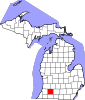 | |
| Villages | ||
| Charter townships | ||
| General law townships | ||
| CDPs | ||
| Other communities | ||
| International | |
|---|---|
| National | |