
Hayes Township, Swift County, Minnesota
Hayes Township, Minnesota | |
|---|---|
 Hayes Township, Minnesota Location within the state of Minnesota  Hayes Township, Minnesota Hayes Township, Minnesota (the United States) | |
| Coordinates: 45°17′5″N 95°18′27″W / 45.28472°N 95.30750°W | |
| Country | United States |
| State | Minnesota |
| County | Swift |
| Area | |
| • Total | 35.9 sq mi (93.0 km2) |
| • Land | 34.9 sq mi (90.3 km2) |
| • Water | 1.0 sq mi (2.7 km2) |
| Elevation | 1,158 ft (353 m) |
| Population (2000) | |
| • Total | 221 |
| • Density | 6.3/sq mi (2.4/km2) |
| Time zone | UTC-6 (Central (CST)) |
| • Summer (DST) | UTC-5 (CDT) |
| FIPS code | 27-27854[1] |
| GNIS feature ID | 0664423[2] |
Hayes Township is a township in Swift County, Minnesota, United States. The population was 221 at the 2000 census.
Hayes Township was organized in 1877, and named for Rutherford B. Hayes, 19th President of the United States (1877–1881).[3]
Geography[edit]
According to the United States Census Bureau, the township has a total area of 35.9 square miles (93 km2), of which 34.9 square miles (90 km2) is land and 1.0 square mile (2.6 km2) (2.87%) is water.
Demographics[edit]
As of the census[1] of 2000, there were 221 people, 85 households, and 69 families residing in the township. The population density was 6.3 inhabitants per square mile (2.4/km2). There were 93 housing units at an average density of 2.7 per square mile (1.0/km2). The racial makeup of the township was 100.00% White.
There were 85 households, out of which 34.1% had children under the age of 18 living with them, 77.6% were married couples living together, and 18.8% were non-families. 15.3% of all households were made up of individuals, and 3.5% had someone living alone who was 65 years of age or older. The average household size was 2.60 and the average family size was 2.90.
In the township the population was spread out, with 24.4% under the age of 18, 5.4% from 18 to 24, 27.6% from 25 to 44, 24.9% from 45 to 64, and 17.6% who were 65 years of age or older. The median age was 41 years. For every 100 females, there were 104.6 males. For every 100 females age 18 and over, there were 119.7 males.
The median income for a household in the township was $39,583, and the median income for a family was $44,643. Males had a median income of $30,625 versus $21,607 for females. The per capita income for the township was $29,279. About 6.1% of families and 10.8% of the population were below the poverty line, including 5.6% of those under the age of eighteen and 5.9% of those 65 or over.
References[edit]
- ^ a b "U.S. Census website". United States Census Bureau. Retrieved January 31, 2008.
- ^ "US Board on Geographic Names". United States Geological Survey. October 25, 2007. Retrieved January 31, 2008.
- ^ Upham, Warren (1920). Minnesota Geographic Names: Their Origin and Historic Significance. Minnesota Historical Society. p. 541.
Municipalities and communities of Swift County, Minnesota, United States | ||
|---|---|---|
| Cities | 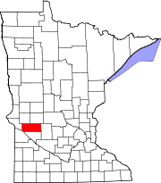 | |
| Townships | ||
| Unincorporated communities | ||