User:Rfl
The original version of this page is located at en.wikipedia.org/wiki/User:Rfl and makes sense only in the context of Wikipedia.

Rafał Pocztarski[edit]
Administrator of the English Wikipedia since 2004 (original nomination)
My Contributions:
All ·
Articles ·
Talk ·
User talk ·
Wiki · Wiki talk · Page Deletions ·
Current rights
Quick links[edit]
Shortcuts[edit]
Rules[edit]
Simplified ruleset: WP:SIMPLE · Policies and guidelines: WP:PG WP:POLICY WP:GUIDELINE · Five pillars: WP:FIVE WP:5P WP:FIVEPILLARS
Neutral point of view: WP:NPOV WP:NPV · Verifiability: WP:V WP:VERIFY WP:SOURCE · No original research: WP:OR WP:NOR WP:ORIGINAL
What Wikipedia is not: WP:! WP:NOT WP:WWIN
Sources[edit]
Primary, secondary and tertiary sources: WP:PSTS WP:PRIMARY WP:SECONDARY Third-party sources: WP:THIRDPARTY WP:3PARTY WP:INDEPENDENT
Identifying reliable sources: WP:IRS WP:RS WP:RELY WP:RELIABLE WP:RELIABLESOURCES · Wikipedia:Notability: WP:N WP:NN WP:NOTE
Abuse[edit]
Vandalism: WP:VAN WP:VAND WP:VNDL WP:VANDAL · Warning templates · Administrator intervention against vandalism: WP:AIV WP:AIAV WP:RVAN
Abuse response: WP:ABUSE WP:AbRep · Cleaning up vandalism: WP:CUV · WikiProject Vandalism studies: WP:WPVS
Requests for page protection: WP:RFPP WP:RFP WP:RPP WP:PADLOCK · Protection policy: WP:PP WP:PROTECT
Misc[edit]
Picture of the day[edit]
Featured pictures · visible · candidates
Selected anniversaries[edit]
May 2: National Day of Prayer in the United States (2024); Flag Day in Poland
- 1559 – Presbyterian clergyman John Knox returned from exile to lead the Scottish Reformation.
- 1889 – The Treaty of Wuchale was signed, ending the Italo-Ethiopian War, but differences in translation later led to another war.
- 1964 – Vietnam War: An explosion caused by Viet Cong commandos led USNS Card to sink in the port of Saigon.
- 1999 – Mireya Moscoso (pictured) became the first woman to be elected President of Panama.
- 2014 – Two mudslides in Badakhshan Province, Afghanistan, killed at least 350 people.
- Marutha of Tikrit (d. 649)
- Mary Moser (d. 1819)
- Giacomo Meyerbeer (d. 1864)
- Engelbert Humperdinck (b. 1936)
In the news[edit]
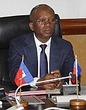
- Acting prime minister of Haiti Ariel Henry resigns, and is replaced by Michel Patrick Boisvert (pictured) while the Transitional Presidential Council is sworn in.
- The Ownership, Unity and Responsibility Party, led by Prime Minister Manasseh Sogavare, wins the most seats in the Solomon Islands general election but falls short of a majority.
- NASA announces that the Voyager 1 space probe is sending readable data for the first time in five months.
- The HDZ-led coalition wins the most seats in the Croatian parliamentary election but falls short of a majority.
- Ichthyotitan, the largest known marine reptile, is formally described.
Wikipedia is written by volunteer editors and hosted by the Wikimedia Foundation, a non-profit organization that also hosts a range of other volunteer projects:
-
Commons
Free media repository -
MediaWiki
Wiki software development -
Meta-Wiki
Wikimedia project coordination -
Wikibooks
Free textbooks and manuals -
Wikidata
Free knowledge base -
Wikinews
Free-content news -
Wikiquote
Collection of quotations -
Wikisource
Free-content library -
Wikispecies
Directory of species -
Wikiversity
Free learning tools -
Wikivoyage
Free travel guide -
Wiktionary
Dictionary and thesaurus


