
Jericho, Arkansas
Jericho, Arkansas | |
|---|---|
 Jericho, AR | |
 Location of Jericho in Crittenden County, Arkansas. | |
| Coordinates: 35°17′16″N 90°13′50″W / 35.28778°N 90.23056°W | |
| Country | United States |
| State | Arkansas |
| County | Crittenden |
| Area | |
| • Total | 0.31 sq mi (0.79 km2) |
| • Land | 0.31 sq mi (0.79 km2) |
| • Water | 0.00 sq mi (0.00 km2) |
| Elevation | 226 ft (69 m) |
| Population (2020) | |
| • Total | 98 |
| • Density | 319.22/sq mi (123.36/km2) |
| Time zone | UTC-6 (Central (CST)) |
| • Summer (DST) | UTC-5 (CDT) |
| ZIP code | 72327 |
| Area code | 870 |
| FIPS code | 05-35140 |
| GNIS feature ID | 2405915[2] |
Jericho is a town in Crittenden County, Arkansas, United States. The population was 119 at the 2010 census,[3] down from 184 in 2000.
Geography[edit]
Jericho is located in northern Crittenden County at 35°17′12″N 90°13′39″W / 35.286550°N 90.227498°W.[4] It lies along Arkansas Highway 77, 10 miles (16 km) north of West Memphis.
According to the United States Census Bureau, the town has a total area of 0.46 square miles (1.2 km2), all land.[3]
Demographics[edit]
| Census | Pop. | Note | %± |
|---|---|---|---|
| 1990 | 210 | — | |
| 2000 | 184 | −12.4% | |
| 2010 | 119 | −35.3% | |
| 2020 | 98 | −17.6% | |
| U.S. Decennial Census[5] | |||
As of the census[6] of 2000, there were 184 people, 66 households, and 46 families residing in the town. The population density was 151.2/km2 (394.6/mi2). There were 73 housing units at an average density of 60.0/km2 (156.5/mi2). The racial makeup of the town was 4.35% White, 92.93% Black or African American, 0.54% from other races, and 2.17% from two or more races. 2.72% of the population were Hispanic or Latino of any race.
There were 66 households, out of which 19.7% had children under the age of 18 living with them, 40.9% were married couples living together, 27.3% had a female householder with no husband present, and 30.3% were non-families. 27.3% of all households were made up of individuals, and 13.6% had someone living alone who was 65 years of age or older. The average household size was 2.79 and the average family size was 3.50.
In the town, the population was spread out, with 25.5% under the age of 18, 6.5% from 18 to 24, 25.5% from 25 to 44, 23.4% from 45 to 64, and 19.0% who were 65 years of age or older. The median age was 40 years. For every 100 females, there were 75.2 males. For every 100 females age 18 and over, there were 77.9 males.
The median income for a household in the town was $20,625, and the median income for a family was $28,214. Males had a median income of $22,250 versus $13,125 for females. The per capita income for the town was $8,577. About 25.0% of families and 25.4% of the population were below the poverty line, including 20.0% of those under the age of eighteen and 56.8% of those 65 or over.
Education[edit]
Jericho is in the Marion School District.[7] Its comprehensive high school is Marion High School.
References[edit]
- ^ "2020 U.S. Gazetteer Files". United States Census Bureau. Retrieved October 29, 2021.
- ^ a b U.S. Geological Survey Geographic Names Information System: Jericho, Arkansas
- ^ a b "Geographic Identifiers: 2010 Demographic Profile Data (G001): Edmondson town, Arkansas". U.S. Census Bureau, American Factfinder. Archived from the original on February 12, 2020. Retrieved June 20, 2014.
- ^ "US Gazetteer files: 2010, 2000, and 1990". United States Census Bureau. February 12, 2011. Retrieved April 23, 2011.
- ^ "Census of Population and Housing". Census.gov. Retrieved June 4, 2015.
- ^ "U.S. Census website". United States Census Bureau. Retrieved January 31, 2008.
- ^ "2020 CENSUS - SCHOOL DISTRICT REFERENCE MAP: Crittenden County, AR" (PDF). U.S. Census Bureau. Retrieved September 22, 2022.
External links[edit]
Municipalities and communities of Crittenden County, Arkansas, United States | ||
|---|---|---|
| Cities | 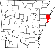 | |
| Towns | ||
| Unincorporated communities | ||