
Yubara, Okayama
This article needs additional citations for verification. (August 2009) |
Yubara
湯原町 | |
|---|---|
Former municipality | |
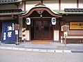
 Former Yubara town hall | |
 Yubara Location in Japan | |
| Coordinates: 35°11′41.9″N 133°43′52.9″E / 35.194972°N 133.731361°E | |
| Country | Japan |
| Region | Chūgoku |
| Prefecture | Okayama Prefecture |
| District | Maniwa |
| Merged | March 31, 2005 (now part of Maniwa) |
| Area | |
| • Total | 141.37 km2 (54.58 sq mi) |
| Population (2003) | |
| • Total | 3,310 |
| • Density | 23.41/km2 (60.6/sq mi) |
| Time zone | UTC+09:00 (JST) |
| Symbols | |
| Bird | Japanese bush-warbler |
| Flower | Prunus mume |
| Tree | Cryptomeria |
Yubara (湯原町, Yubara-chō) was a town located in Maniwa District, Okayama Prefecture, Japan.
As of 2003, the town had an estimated population of 3,310 and a density of 23.41 persons per km2. The total area was 141.37 km2.
On March 31, 2005, Yubara, along with the town of Hokubō (from Jōbō District), and towns of Katsuyama, Kuse and Ochiai, and the villages of Chūka, Kawakami, Mikamo and Yatsuka (all from Maniwa District) were merged to create the city of Maniwa.[1][2]
The historic town is nestled in a ravine and follows the meandering path of the Asahi River. The village is surrounded, on all sides by trees clinging to the hillsides. (There are small logging operations in the region that the bus passes on the way into town.) The town sits at the base of Yubara Dam. There are a number onsen hotels. There is also an outdoor, mixed bathing bath, or rotenburo, by the river. This facility is free. The waters are said to have healing effects on those suffering from diabetes, chronic women's diseases, chronic skin disease, cuts and burns.[3]
Geography[edit]
- Rivers: Asahi River (The big-3 river through Okayama Prefecture)
Adjoining municipalities[edit]
Education[edit]
- Yubara Elementary School
- Futakawa Elementary School
- Yubara Junior High School
Transportation[edit]
- Expressways:
- Yonago Expressway
- Yubara Interchange
- Yonago Expressway
- National highways:
- Prefectural roads:
Notable places and events[edit]
- Yubara Onsen
- Yubara Dam (Lake Yubara)
-
 Open-air hot springs
 -
 Onsen
Onsen


External links[edit]
- Official website of Maniwa in Japanese
- Yubara Onsen
References[edit]
- ^ "真庭市の概要 - 真庭市公式ホームページ". Maniwa City. Retrieved 2024-02-07.
真庭市は、平成17年3月31日に当時の真庭郡勝山町、落合町、湯原町、久世町、美甘村、川上村、八束村、中和村及び上房郡北房町の9町村が合併して誕生しました。
- ^ 住民基本台帳人口移動報告年報 [Annual Report on Population Movement in the Basic Resident Register] (in Japanese). 総務庁統計局. 2005. p. 147.
Hokubo-cho, Katsuyama-cho, Ochiai-cho, Yubara-cho, Kuse-cho, Mikamo-son, Kawakami-son, Yatsuka-son and Chuka-son were incorporated into a newly established Maniwa-shi as of March 31, 2005.
- ^ "Yubara Water". Retrieved 24 June 2012.
| International | |
|---|---|
| National | |
This Okayama Prefecture location article is a stub. You can help Wikipedia by expanding it. |